ATLAS OF THE POLAR REGIONS
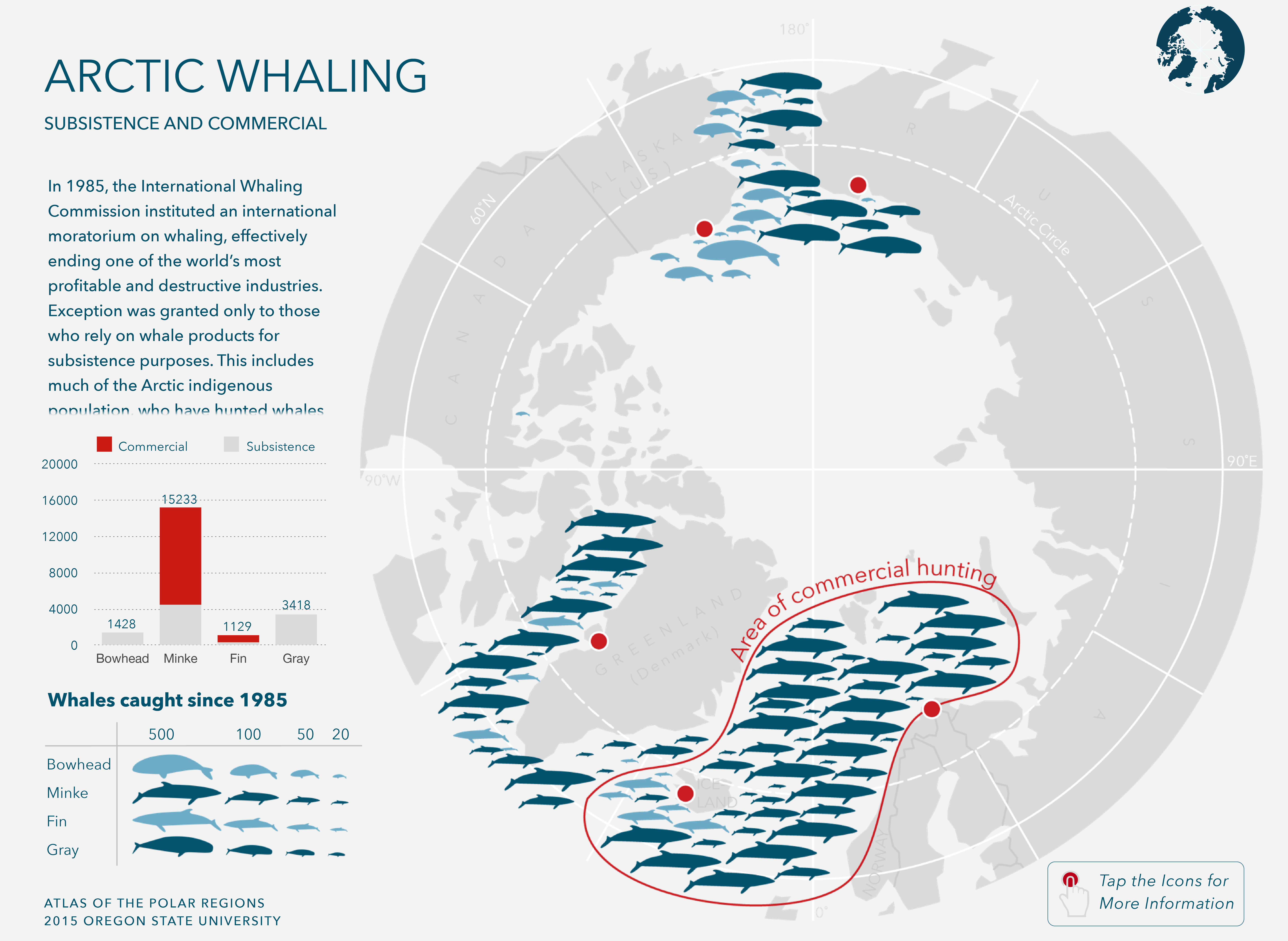
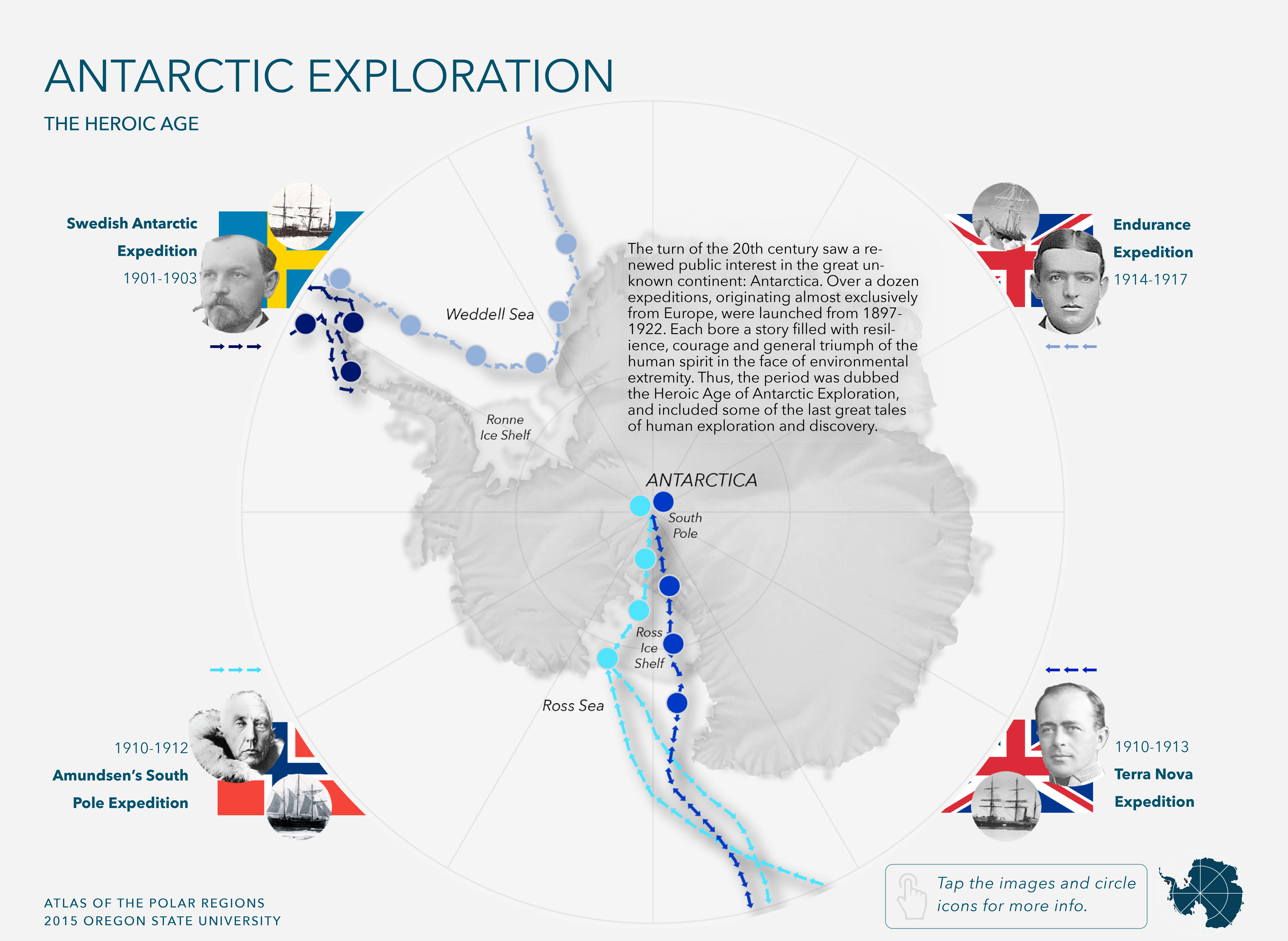
This atlas was made for a computer-assisted cartography class at Oregon State University, and below are the maps I contributed. These were my first published maps, and the first project which made me think I could pursue cartography professionally. While the maps aren’t perfect (they could certainly use an uncertainty indicator), I’m happy with how they turned out!
The maps can be found here.

